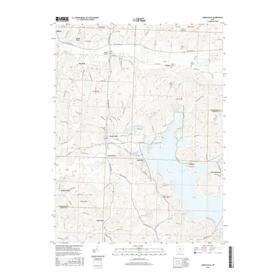
2016 Map of Senecaville
USGS Topo · Published 2016About this map
Senecaville Lake and its intricate northern shoreline dominate the southeastern portion of this Guernsey and Noble County border region. The village of Senecaville serves as a central hub, surrounded by smaller historical clusters such as Lore City, Kipling, and Kennonsburg. The landscape is a mix of dense rural road networks and water features, including the Seneca Fork Wills Creek and Leatherwood Cr.
Find a feature on this map
124 named features on this map. Tap any name to fly to it.
Don’t see what you’re looking for? This feature index may not catch every label — zoom into the map to look around manually.
Map Details
Editions of this 2016 Senecaville Map
This is the sole edition of this map. No revisions or reprints were ever made.
Other maps of this area

1909 · Antrim
USGS Topo · 1:48,000

1909 · Summerfield
USGS Topo · 1:62,500

1909 · Cambridge
USGS Topo · 1:62,500

1911 · Antrim
USGS Topo · 1:62,500

1911 · Cumberland
USGS Topo · 1:62,500

1911 · Summerfield
USGS Topo · 1:62,500

1912 · Cambridge
USGS Topo · 1:62,500

1949 · Clarksburg
USGS Topo · 1:250,000

1951 · Canton
USGS Topo · 1:250,000

1953 · Canton
USGS Topo · 1:250,000