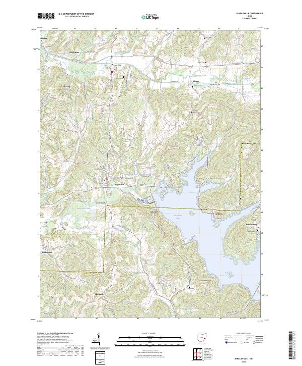
2023 Map of Senecaville
USGS Topo · Published 2023About this map
Senecaville Lake dominates the southeastern quadrant of this landscape, its irregular shoreline creating a complex geography of inlets and peninsulas where Guernsey and Noble Counties meet. The area is characterized by a high density of rural burial sites, such as the Saint Patricks Cem and Salem Baptist Cem, which serve as quiet markers of the region's 19th-century church congregations and family lineages.
Find a feature on this map
113 named features on this map. Tap any name to fly to it.
Don’t see what you’re looking for? This feature index may not catch every label — zoom into the map to look around manually.
Map Details
Editions of this 2023 Senecaville Map
This is the sole edition of this map. No revisions or reprints were ever made.
Other maps of this area

1909 · Antrim
USGS Topo · 1:48,000

1909 · Summerfield
USGS Topo · 1:62,500

1909 · Cambridge
USGS Topo · 1:62,500

1911 · Antrim
USGS Topo · 1:62,500

1911 · Cumberland
USGS Topo · 1:62,500

1911 · Summerfield
USGS Topo · 1:62,500

1912 · Cambridge
USGS Topo · 1:62,500

1949 · Clarksburg
USGS Topo · 1:250,000

1951 · Canton
USGS Topo · 1:250,000

1953 · Canton
USGS Topo · 1:250,000