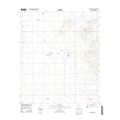
2013 Map of Sentinel Butte
USGS Topo · Published 2013About this map
The Alamo Hueco Mountains dominate the eastern landscape of this corner of Hidalgo County, rising sharply above the desert floor. The map highlights a remote transition between the high peaks and the broad expanse of the Playas Valley to the west. This arid environment is defined by its drainage patterns, with seasonal watercourses like Bear Cr, Willow Cr, and Bull Cr etching paths through the basin. Landmarks such as Sentinel Butte serve as distinct navigational points in an area otherwise characterized by vast stretches of open rangeland. The presence of Alamo Hueco Rd and various county routes suggests the enduring importance of ranching access in this borderland region. Geologic features including Black Canyon and Wood Canyon provide insight into the erosional forces shaping the mountainous terrain near Alamo Hueco.
Find a feature on this map
18 named features on this map. Tap any name to fly to it.
Don’t see what you’re looking for? This feature index may not catch every label — zoom into the map to look around manually.
Map Details
Editions of this 2013 Sentinel Butte Map
This is the sole edition of this map. No revisions or reprints were ever made.
Other maps of this area

1917 · Antelope Wells
USGS Topo · 1:62,500

1918 · Big Hatchet Peak
USGS Topo · 1:62,500

1918 · Dog Mountains
USGS Topo · 1:62,500

1918 · Walnut Wells
USGS Topo · 1:62,500

1919 · Antelope Wells
USGS Topo · 1:62,500

1923 · Walnut Wells
USGS Topo · 1:62,500

1955 · Douglas
USGS Topo · 1:250,000

1959 · Douglas
USGS Topo · 1:250,000

1961 · Douglas
USGS Topo · 1:250,000

1964 · Douglas
USGS Topo · 1:250,000