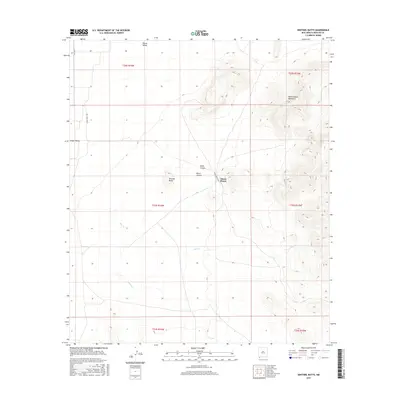
2017 Map of Sentinel Butte
USGS Topo · Published 2017About this map
Alamo Hueco Mountains dominate the eastern reaches of this borderlands landscape, casting shadows over the high-desert drainages that define the local topography. This 2017 survey details the remote cattle country and rugged peaks of southern Hidalgo County, where the settlement of Alamo Hueco sits near the mouth of Wood Canyon and Black Canyon. To the west, the terrain opens into the broad Playas Valley, a stark contrast to the prominent rise of Sentinel Butte which serves as a significant navigational landmark in the basin. The map tracks the seasonal hydrology of the region, tracing the intermittent paths of Bear Cr, Willow Cr, and Bull Cr as they move water across the alluvial fans. This modern US Topo edition maintains the traditional Public Land Survey System grid, including boundaries for t33s r16w and t33s r15w.
Find a feature on this map
17 named features on this map. Tap any name to fly to it.
Don’t see what you’re looking for? This feature index may not catch every label — zoom into the map to look around manually.
Map Details
Editions of this 2017 Sentinel Butte Map
This is the sole edition of this map. No revisions or reprints were ever made.
Other maps of this area

1917 · Antelope Wells
USGS Topo · 1:62,500

1918 · Big Hatchet Peak
USGS Topo · 1:62,500

1918 · Dog Mountains
USGS Topo · 1:62,500

1918 · Walnut Wells
USGS Topo · 1:62,500

1919 · Antelope Wells
USGS Topo · 1:62,500

1923 · Walnut Wells
USGS Topo · 1:62,500

1955 · Douglas
USGS Topo · 1:250,000

1959 · Douglas
USGS Topo · 1:250,000

1961 · Douglas
USGS Topo · 1:250,000

1964 · Douglas
USGS Topo · 1:250,000