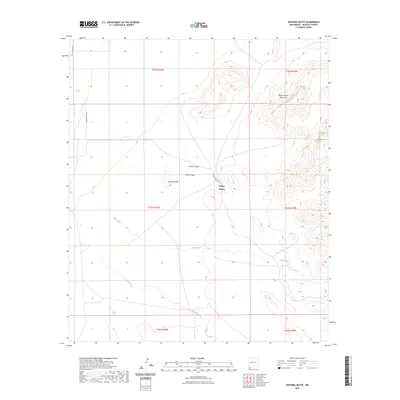
2023 Map of Sentinel Butte
USGS Topo · Published 2023About this map
Alamo Hueco sits at the heart of this high-desert landscape in the southwestern corner of New Mexico, where the plains meet the rising slopes of the Alamo Hueco Mountains. The terrain is defined by dramatic geological features, including the prominent landmark of Sentinel Butte and the deep incisions of Wood Canyon and Black Canyon. These canyons and the surrounding drainages, such as Bear Creek, Bull Creek, and Willow Creek, illustrate the complex hydrology of Hidalgo County. Access to this remote region is primary facilitated by Alamo Hueco Rd, which traverses the basin. This survey documents the area's essential geographic character, from its sharp topographic relief to the sparse but critical network of seasonal watercourses that shape the southern New Mexico borderlands.
Find a feature on this map
15 named features on this map. Tap any name to fly to it.
Don’t see what you’re looking for? This feature index may not catch every label — zoom into the map to look around manually.
Map Details
Editions of this 2023 Sentinel Butte Map
This is the sole edition of this map. No revisions or reprints were ever made.
Other maps of this area

1917 · Antelope Wells
USGS Topo · 1:62,500

1918 · Big Hatchet Peak
USGS Topo · 1:62,500

1918 · Dog Mountains
USGS Topo · 1:62,500

1918 · Walnut Wells
USGS Topo · 1:62,500

1919 · Antelope Wells
USGS Topo · 1:62,500

1923 · Walnut Wells
USGS Topo · 1:62,500

1955 · Douglas
USGS Topo · 1:250,000

1959 · Douglas
USGS Topo · 1:250,000

1961 · Douglas
USGS Topo · 1:250,000

1964 · Douglas
USGS Topo · 1:250,000