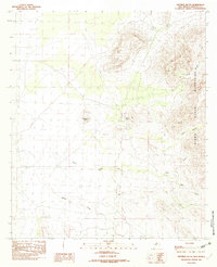
1982 Map of Sentinel Butte
USGS Topo · Published 1982About this map
Sentinel Butte rises as a prominent landmark in this arid portion of the Hueco Mountains in the early 1980s. The landscape is defined by its drainage systems and water management features, critical for life and livestock in the New Mexico borderlands. Seasonal watercourses like Bear Creek, Willow Creek, and Bull Creek cut through the terrain, while human interventions are visible through the presence of a Check Dam and the Pp2 Wind Mill. The area around Alamo Hueco and the deep cuts of Wood Canyon and Black Canyon showcase the geological complexity of the range. A noted Cave and various survey points indicate a landscape that was both a site for ranching infrastructure and remote exploration, where natural topography dictated the placement of every fence line and water source.
Find a feature on this map
14 named features on this map. Tap any name to fly to it.
Don’t see what you’re looking for? This feature index may not catch every label — zoom into the map to look around manually.
Map Details
Editions of this 1982 Sentinel Butte Map
This is the sole edition of this map. No revisions or reprints were ever made.
Other maps of this area

1917 · Antelope Wells
USGS Topo · 1:62,500

1918 · Big Hatchet Peak
USGS Topo · 1:62,500

1918 · Dog Mountains
USGS Topo · 1:62,500

1918 · Walnut Wells
USGS Topo · 1:62,500

1919 · Antelope Wells
USGS Topo · 1:62,500

1923 · Walnut Wells
USGS Topo · 1:62,500

1955 · Douglas
USGS Topo · 1:250,000

1959 · Douglas
USGS Topo · 1:250,000

1961 · Douglas
USGS Topo · 1:250,000

1964 · Douglas
USGS Topo · 1:250,000