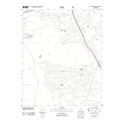
2011 Map of Seton Village
USGS Topo · Published 2011About this map
Seton Village National Historic Landmark stands as a focal point of this high-desert landscape south of Santa Fe, marking the legacy of Ernest Thompson Seton. The 2011 survey reveals a complex settlement pattern, ranging from the historic cluster of Seton Village and the La Loma Post Office to the extensive modern residential development of Eldorado at Santa Fe. The terrain is defined by dramatic arroyos and canyons, including Piedras Negras Canyon and Arroyo Hondo, which dictate the winding paths of roads like the Old Santa Fe Trail. A notable industrial trace is the Old Railroad Bed, which cuts through the western portion of the map near Gallina Camp. This mix of established ranches like Ninemile Ranch and growing suburban communities illustrates the evolution of land use on the outskirts of the state capital, where traditional corridors like the Old Las Vegas Highway continue to serve as primary arteries.
Find a feature on this map
69 named features on this map. Tap any name to fly to it.
Don’t see what you’re looking for? This feature index may not catch every label — zoom into the map to look around manually.
Map Details
Editions of this 2011 Seton Village Map
This is the sole edition of this map. No revisions or reprints were ever made.
Other maps of this area

1889 · Santa Fe
USGS Topo · 1:125,000

1892 · San Pedro
USGS Topo · 1:125,000

1892 · Santa Clara
USGS Topo · 1:125,000

1894 · Santa Fe
USGS Topo · 1:125,000

1894 · Lamy
USGS Topo · 1:125,000

1951 · Agua Fria
USGS Topo · 1:24,000

1951 · Turquoise Hill
USGS Topo · 1:24,000

1952 · Santa Fe
USGS Topo · 1:24,000

1952 · Turquoise Hill
USGS Topo · 1:24,000

1952 · Seton Village
USGS Topo · 1:24,000