
1976 Map of Seven Islands
USGS Topo · Published 1983About this map
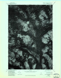
St. John River currents dominate this aerial perspective of the Maine North Woods, captured during an orthophotographic survey in the mid-1970s. The waterway winds through a dense timberland landscape where industrial forestry tracks and logging roads have carved a grid into the forest canopy. The most distinctive geographical feature is the Seven Islands complex, a series of alluvial landforms and river channels that break the main flow of the St. John. Small tributaries like Lizotte Brook and Priestly Brook drain the surrounding heights, while White Pond sits in the upland terrain. This imagery provides a rare literal view of the backcountry landscape before modern reforestation and changing land management practices altered the visible scars of twentieth-century logging operations.
Find a feature on this map
5 named features on this map. Tap any name to fly to it.
Don’t see what you’re looking for? This feature index may not catch every label — zoom into the map to look around manually.
Map Details
Editions of this 1976 Seven Islands Map
This is the sole edition of this map. No revisions or reprints were ever made.
Other maps of this area

1932 · Umsaskis Lake
USGS Topo · 1:48,000

1935 · Umsaskis Lake
USGS Topo · 1:62,500

1954 · Presque Isle
USGS Topo · 1:250,000

1955 · Round Pond
USGS Topo · 1:62,500

1955 · Clayton Lake
USGS Topo · 1:62,500

1955 · Seven Islands
USGS Topo · 1:62,500

1958 · Presque Isle
USGS Topo · 1:250,000

1960 · Presque Isle
USGS Topo · 1:250,000
1976 · Ninemile Deadwater
USGS Topo · 1:24,000
1977 · Charles Pond
USGS Topo · 1:24,000