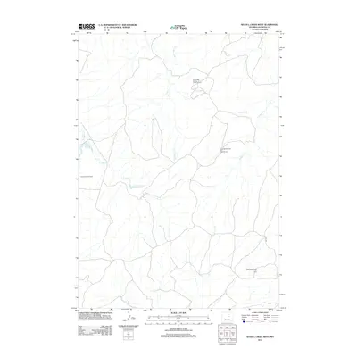
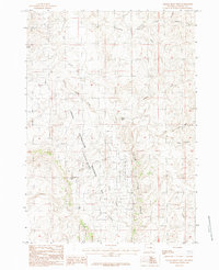
2012 Map of Seven L Creek West
USGS Topo · Published 2012About this map
The high plains of Natrona County are defined by a complex network of ephemeral waterways and industrial development in this early 21st-century study. The landscape is characterized by the Little Teapot Cr and its tributaries, including E Teapot Cr, which feed into local catchments like the Houston Reservoir and the School Section Reservoir. These water sources are vital in an area otherwise dominated by the energy industry, as evidenced by several significant drilling operations across the quadrangle. Extensive petroleum infrastructure is mapped in detail, specifically the North Sage Spring Creek Oil Field, Burke Ranch Oil Field, and multiple zones of the Sage Spring Creek Oil Field. The presence of the Allemand Ranch and thoroughfares like Naval Rd illustrate the ongoing relationship between traditional ranching and the modern mineral extraction economy in this part of Wyoming.
Find a feature on this map
11 named features on this map. Tap any name to fly to it.
Don’t see what you’re looking for? This feature index may not catch every label — zoom into the map to look around manually.
Map Details
Editions of this 2012 Seven L Creek West Map
This is the sole edition of this map. No revisions or reprints were ever made.
Other maps of this area

1955 · Arminto
USGS Topo · 1:250,000

1958 · Arminto
USGS Topo · 1:250,000

1959 · Edgerton
USGS Topo · 1:62,500

1959 · Ormsby Draw
USGS Topo · 1:62,500

1962 · Arminto
USGS Topo · 1:250,000

1968 · Salt Creek
USGS Topo · 1:24,000
1968 · Teapot Rock
USGS Topo · 1:24,000
1968 · Mc Pherson Draw
USGS Topo · 1:24,000
1981 · Midwest
USGS Topo · 1:100,000
1984 · Gillam Draw West
USGS Topo · 1:24,000