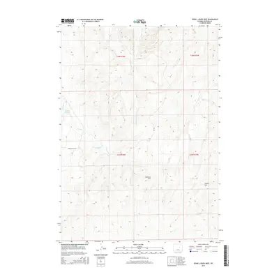
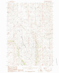
2015 Map of Seven L Creek West
USGS Topo · Published 2015About this map
Houston Reservoir and School Section Reservoir define the water management landscape of this high plains section of Natrona County. The drainage patterns are dominated by the winding paths of Little Teapot Cr and E Teapot Cr in the north and west, while the eastern portion is shaped by the ephemeral flows of Seven L Cr. This 2015 survey illustrates a terrain primarily utilized for resource management and ranching, intersected by local routes like Twentymile Hill Rd and Npr No 3. The landscape is characterized by its broad topographic depressions, including McKenzie Draw and Coopers Draw, which are typical of the central Wyoming basins where seasonal water flow dictates the location of modern infrastructure and traditional land use boundaries.
Find a feature on this map
13 named features on this map. Tap any name to fly to it.
Don’t see what you’re looking for? This feature index may not catch every label — zoom into the map to look around manually.
Map Details
Editions of this 2015 Seven L Creek West Map
This is the sole edition of this map. No revisions or reprints were ever made.
Other maps of this area

1955 · Arminto
USGS Topo · 1:250,000

1958 · Arminto
USGS Topo · 1:250,000

1959 · Edgerton
USGS Topo · 1:62,500

1959 · Ormsby Draw
USGS Topo · 1:62,500

1962 · Arminto
USGS Topo · 1:250,000

1968 · Salt Creek
USGS Topo · 1:24,000
1968 · Teapot Rock
USGS Topo · 1:24,000
1968 · Mc Pherson Draw
USGS Topo · 1:24,000
1981 · Midwest
USGS Topo · 1:100,000
1984 · Gillam Draw West
USGS Topo · 1:24,000