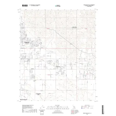
2018 Map of Seven Palms Valley
USGS Topo · Published 2018About this map
Desert Hot Springs and the surrounding desert communities anchor this 2018 survey of the northern Coachella Valley. The map documents the intricate grid of residential streets and arterial roads like Pierson Blvd and Dillon Rd that connect Desert Edge and Garnet. Essential water infrastructure is prominently featured, including the Colorado River Aqueduct and the Coachella Tunnels as they emerge from the rugged terrain of the Little San Bernardino Mountains.
Find a feature on this map
127 named features on this map. Tap any name to fly to it.
Don’t see what you’re looking for? This feature index may not catch every label — zoom into the map to look around manually.
Map Details
Editions of this 2018 Seven Palms Valley Map
This is the sole edition of this map. No revisions or reprints were ever made.
Other maps of this area

1901 · Southern California Sheet No. 1
USGS Topo · 1:250,000

1901 · San Jacinto
USGS Topo · 1:125,000

1902 · San Gorgonio
USGS Topo · 1:125,000

1904 · Southern California Sheet No. 1
USGS Topo · 1:250,000

1940 · Palm Springs
USGS Topo · 1:62,500

1941 · Edom
USGS Topo · 1:62,500

1944 · Palm Springs
USGS Topo · 1:62,500

1944 · Edom
USGS Topo · 1:62,500

1947 · Santa Ana
USGS Topo · 1:250,000

1949 · Santa Ana
USGS Topo · 1:250,000