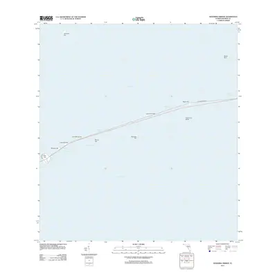
2012 Map of Sevenmile Bridge
USGS Topo · Published 2012About this map
Sevenmile Bridge serves as the dominant structural spine of this maritime landscape, stretching across the open waters of Moser Channel and Money Key Channel. This survey documents the modern transportation corridor alongside remnants of the Old Sevenmile Brg, illustrating the engineering evolution required to span the Florida Keys. The map details a series of small landmasses including Pigeon Key, which sits directly beneath the bridge alignment, and the more remote Molasses Key and Money Key to the south. Surrounding these outcrops, the shallow marine environment is defined by distinct navigational passages such as Pacet Channel and Knight Key Channel, which separate the interior Florida Bay from the southern Hawk Channel. This coastal depiction provides a precise look at the geography of the Middle Keys during the early 21st century.
Find a feature on this map
22 named features on this map. Tap any name to fly to it.
Don’t see what you’re looking for? This feature index may not catch every label — zoom into the map to look around manually.
Map Details
Editions of this 2012 Sevenmile Bridge Map
This is the sole edition of this map. No revisions or reprints were ever made.
Other maps of this area

1971 · Marathon
USGS Topo · 1:24,000

1972 · Marathon
USGS Topo · 1:24,000

1972 · Bamboo Key
USGS Topo · 1:24,000

1972 · Big Pine Key
USGS Topo · 1:24,000

1972 · East Bahia Honda Key
USGS Topo · 1:24,000

1972 · Horseshoe Keys
USGS Topo · 1:24,000

1972 · Sevenmile Bridge
USGS Topo · 1:24,000

1983 · Key West
USGS Topo · 1:100,000

1989 · Key West
USGS Topo · 1:250,000
2012 · Horseshoe Keys
USGS Topo · 1:24,000