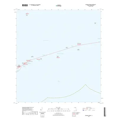
2018 Map of Sevenmile Bridge
USGS Topo · Published 2018About this map
Sevenmile Bridge serves as the central spine of this maritime landscape, threading together the Florida Keys across the open waters of the Atlantic Ocean. This survey documents a critical segment of the Overseas Highway corridor where the engineering feat of the bridge spans the Moser Channel. The map illustrates the sequence of keys along this transit line, including Pigeon Key, Money Key, and the cluster containing Little Duck Key, Missouri Key, and Ohio Key.
Find a feature on this map
24 named features on this map. Tap any name to fly to it.
Don’t see what you’re looking for? This feature index may not catch every label — zoom into the map to look around manually.
Map Details
Editions of this 2018 Sevenmile Bridge Map
This is the sole edition of this map. No revisions or reprints were ever made.
Other maps of this area

1971 · Marathon
USGS Topo · 1:24,000

1972 · Marathon
USGS Topo · 1:24,000

1972 · Bamboo Key
USGS Topo · 1:24,000

1972 · Big Pine Key
USGS Topo · 1:24,000

1972 · East Bahia Honda Key
USGS Topo · 1:24,000

1972 · Horseshoe Keys
USGS Topo · 1:24,000

1972 · Sevenmile Bridge
USGS Topo · 1:24,000

1983 · Key West
USGS Topo · 1:100,000

1989 · Key West
USGS Topo · 1:250,000
2012 · Horseshoe Keys
USGS Topo · 1:24,000