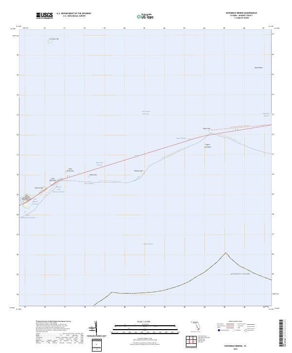
2024 Map of Sevenmile Bridge
USGS Topo · Published 2024About this map
Pigeon Key and a string of smaller islands define this passage between the Middle and Lower Keys, marking a critical crossing of the Moser Channel. The landscape is dominated by the narrow transportation corridor of the Florida Keys Overseas Heritage Trl as it leaps from Knight Key Channel toward Little Duck Key. Large portions of the surrounding waters and islets are protected within the National Key Deer Refuge and the Great White Heron National Wildlife Refuge, indicating the preservation of vital marine and avian habitats.
Find a feature on this map
27 named features on this map. Tap any name to fly to it.
Don’t see what you’re looking for? This feature index may not catch every label — zoom into the map to look around manually.
Map Details
Editions of this 2024 Sevenmile Bridge Map
This is the sole edition of this map. No revisions or reprints were ever made.
Other maps of this area

1971 · Marathon
USGS Topo · 1:24,000

1972 · Marathon
USGS Topo · 1:24,000

1972 · Bamboo Key
USGS Topo · 1:24,000

1972 · Big Pine Key
USGS Topo · 1:24,000

1972 · East Bahia Honda Key
USGS Topo · 1:24,000

1972 · Horseshoe Keys
USGS Topo · 1:24,000

1972 · Sevenmile Bridge
USGS Topo · 1:24,000

1983 · Key West
USGS Topo · 1:100,000

1989 · Key West
USGS Topo · 1:250,000
2012 · Horseshoe Keys
USGS Topo · 1:24,000