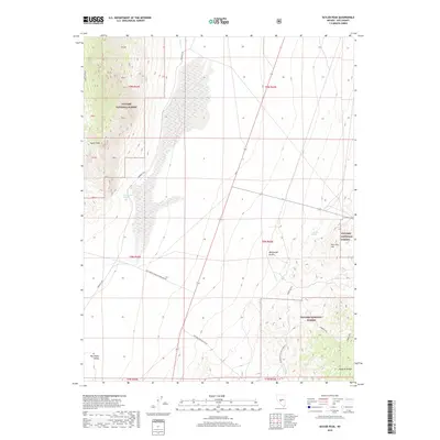
2018 Map of Seyler Peak
USGS Topo · Published 2018About this map
Seyler Peak rises as a prominent landmark in this desert landscape of Nye County, where the high elevations of the Toquima Range overlook the expanse of the Big Smoky Valley. Much of the terrain is managed within the Toiyabe National Forest, a region defined by its vital water sources such as Coyote Hole Spring and Palo Alto Spring. The transportation network is anchored by the historic Fremont Rte, which skirts the base of the mountains near Wood Canyon. Topographic details reveal the complex drainage patterns of Manhattan Gulch and the distinct rise of Palo Alto Hill. Modern infrastructure, including the Transmission Line Tie Rd and various forest service routes like the Manhattan Willow Connect, shows the 21st-century footprint on this traditional Nevada mining and ranching corridor.
Find a feature on this map
29 named features on this map. Tap any name to fly to it.
Don’t see what you’re looking for? This feature index may not catch every label — zoom into the map to look around manually.
Map Details
Editions of this 2018 Seyler Peak Map
This is the sole edition of this map. No revisions or reprints were ever made.
Other maps of this area

1907 · Tonopah
USGS Topo · 1:250,000

1908 · Tonopah
USGS Topo · 1:250,000

1956 · Tonopah
USGS Topo · 1:250,000

1959 · Tonopah
USGS Topo · 1:250,000

1962 · Tonopah
USGS Topo · 1:250,000

1963 · Baxter Spring
USGS Topo · 1:62,500

1964 · San Antonio Ranch
USGS Topo · 1:62,500

1971 · Seyler Peak
USGS Topo · 1:24,000

1971 · Manhattan
USGS Topo · 1:24,000

1971 · Pablo Canyon Ranch
USGS Topo · 1:24,000