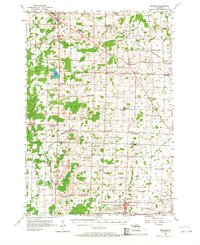
1955 Map of Seymour
USGS Topo · Published 1968About this map
Seymour and Bonduel serve as the primary hubs in this agricultural landscape of northeastern Wisconsin during the mid-1950s. The region is defined by a dense network of small rural school districts and parish churches, many of which were already shifting by this date, as evidenced by several marked as abandoned, such as Sohr Sch and Oak Leaf Sch. These closures suggest the early stages of school consolidation in Outagamie and Shawano counties.
Find a feature on this map
68 named features on this map. Tap any name to fly to it.
Don’t see what you’re looking for? This feature index may not catch every label — zoom into the map to look around manually.
Map Details
Editions of this 1955 Seymour Map
3 editions found
Other maps of this area

1954 · De Pere
USGS Topo · 1:62,500

1954 · Shawano
USGS Topo · 1:48,000

1954 · Green Bay
USGS Topo · 1:62,500

1955 · Embarrass
USGS Topo · 1:48,000

1955 · Appleton
USGS Topo · 1:62,500

1955 · Seymour
USGS Topo · 1:62,500

1955 · Green Bay
USGS Topo · 1:250,000

1956 · Gillett
USGS Topo · 1:62,500

1956 · New London
USGS Topo · 1:48,000

1956 · Oconto Falls
USGS Topo · 1:62,500