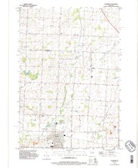
1992 Map of Seymour
USGS Topo · Published 1996About this map
Seymour serves as the primary hub in this topographic survey of the Outagamie and Shawano county line in the early 1990s. The landscape is defined by its agricultural grid and the meandering paths of Black Creek and Toad Creek, which drain toward the West Branch Suamico River. Local community life is anchored by small settlements like Isaar and Rose Lawn, alongside several generational burial grounds including St Sebastian Cem, Seymour Cemetery, and Evangelist Cemetery. In the south, the city of Seymour shows a concentration of civic landmarks, from the local Fairground and Athletic Fields to the recreational Golf Course and Rock Ledge Park. The map also captures the Indian Reservation Boundary of the Oneida nation, providing a clear view of the jurisdictional lines that intersect this rural dairy-farming region.
Find a feature on this map
34 named features on this map. Tap any name to fly to it.
Don’t see what you’re looking for? This feature index may not catch every label — zoom into the map to look around manually.
Map Details
Editions of this 1992 Seymour Map
This is the sole edition of this map. No revisions or reprints were ever made.
Other maps of this area

1954 · De Pere
USGS Topo · 1:62,500

1954 · Green Bay
USGS Topo · 1:62,500

1955 · Appleton
USGS Topo · 1:62,500

1955 · Seymour
USGS Topo · 1:62,500

1955 · Green Bay
USGS Topo · 1:250,000

1974 · Seymour
USGS Topo · 1:24,000

1974 · Zachow
USGS Topo · 1:24,000
1974 · Bonduel
USGS Topo · 1:24,000
1974 · Nichols
USGS Topo · 1:24,000
1974 · Oneida South
USGS Topo · 1:24,000