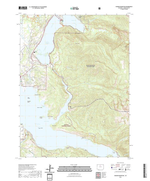
2022 Map of Shadow Mountain
USGS Topo · Published 2022About this map
Grand Lake and its neighboring waters serve as the primary focus of this high-elevation survey of the Colorado River's headwaters. The map illustrates the complex plumbing of the Colorado-Big Thompson Project, featuring the Alva B Adams Tunnel and the Granby Pump Canal, which manage the movement of water through this high-mountain basin. This hydrological engineering sits alongside the massive protected landscapes of Rocky Mountain National Park and the Arapaho National Forest.
Find a feature on this map
97 named features on this map. Tap any name to fly to it.
Don’t see what you’re looking for? This feature index may not catch every label — zoom into the map to look around manually.
Map Details
Editions of this 2022 Shadow Mountain Map
This is the sole edition of this map. No revisions or reprints were ever made.
Other maps of this area

1915 · Longs Peak
USGS Topo · 1:125,000

1919 · Rocky Mountain National Park
USGS Topo · 1:125,000

1954 · Greeley
USGS Topo · 1:250,000

1957 · Greeley
USGS Topo · 1:250,000

1957 · Mc Henrys Peak
USGS Topo · 1:24,000

1957 · Bowen Mountain
USGS Topo · 1:24,000
1957 · Trail Mountain
USGS Topo · 1:24,000
1957 · Granby
USGS Topo · 1:24,000

1958 · Greeley
USGS Topo · 1:250,000
1958 · Strawberry Lake
USGS Topo · 1:24,000