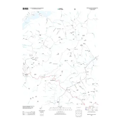
2013 Map of Shady Valley
USGS Topo · Published 2013About this map
South Holston Lake and the high ridges of the Cherokee National Forest define this landscape along the Tennessee and Virginia border. Small mountain settlements like Offset, Crandull, and Twin Oaks sit along the narrow valley floors, while the higher elevations are marked by distinctive landmarks such as the Abingdon Gap Appalachian Trail Shelter and Dogwood Bench. The terrain is deeply inscribed with local family and descriptive names, from Graveyard Ridge to Marriage Ground Ridge, reflecting a long history of human presence in these gaps. Evidence of federal land management and community infrastructure is visible through the Jacobs Creek Job Corps and Camp Tom Howard. The drainage patterns of Beaverdam Cr and Big Jacob Cr shape the movement of people and resources through pass points like Sowbed Gap and Low Gap, connecting the highland ridges with the waters of the South Holston.
Find a feature on this map
140 named features on this map. Tap any name to fly to it.
Don’t see what you’re looking for? This feature index may not catch every label — zoom into the map to look around manually.
Map Details
Editions of this 2013 Shady Valley Map
This is the sole edition of this map. No revisions or reprints were ever made.
Other maps of this area

1891 · Roan Mountain
USGS Topo · 1:125,000

1891 · Abingdon
USGS Topo · 1:125,000

1893 · Cranberry
USGS Topo · 1:125,000

1894 · Roan Mountain
USGS Topo · 1:125,000

1894 · Abingdon
USGS Topo · 1:125,000

1895 · Cranberry
USGS Topo · 1:125,000

1897 · Bristol
USGS Topo · 1:125,000

1899 · Cranberry
USGS Topo · 1:125,000

1902 · Bristol
USGS Topo · 1:125,000

1902 · Cranberry
USGS Topo · 1:125,000