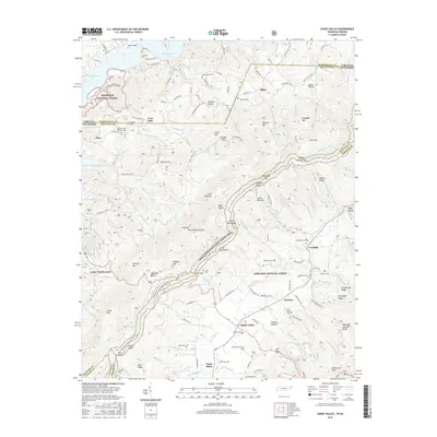
2016 Map of Shady Valley
USGS Topo · Published 2016About this map
The Appalachian National Scenic Trail winds through the high ridges of Holston Mtn, serving as a central spine for this borderland where Tennessee and Virginia meet. In the valley below, the agricultural and timbered landscape is dotted with family settlements like Crandull, Offset, and Upper Shady. The map reveals a dense network of local history, preserved in numerous family burial grounds such as McQueen Cems, Heaberlin Cems, and Gentry Cems.
Find a feature on this map
139 named features on this map. Tap any name to fly to it.
Don’t see what you’re looking for? This feature index may not catch every label — zoom into the map to look around manually.
Map Details
Editions of this 2016 Shady Valley Map
This is the sole edition of this map. No revisions or reprints were ever made.
Other maps of this area

1891 · Roan Mountain
USGS Topo · 1:125,000

1891 · Abingdon
USGS Topo · 1:125,000

1893 · Cranberry
USGS Topo · 1:125,000

1894 · Roan Mountain
USGS Topo · 1:125,000

1894 · Abingdon
USGS Topo · 1:125,000

1895 · Cranberry
USGS Topo · 1:125,000

1897 · Bristol
USGS Topo · 1:125,000

1899 · Cranberry
USGS Topo · 1:125,000

1902 · Bristol
USGS Topo · 1:125,000

1902 · Cranberry
USGS Topo · 1:125,000