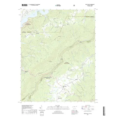
2019 Map of Shady Valley
USGS Topo · Published 2019About this map
South Holston Lake defines the northern edge of this highland landscape, where the waters meet the foot of Jefferson National Forest. This 2019 survey documents a complex of high valleys and ridges where the Appalachian National Scenic Trail winds along the spine of Holston Mountain and through Low Gap. The settlement pattern in Shady Valley and Upper Shady remains tied to the narrow corridors between Iron Mountain and the surrounding national forest lands. Genealogists will find a high concentration of family burial grounds scattered throughout the hollows, including Gentry Cem, Blevins Cem, and Price Cem. Notable landmarks such as Avens Bridge and the Camp-Tom Howard facility provide modern reference points within this long-established agricultural and timber-focused region of northeast Tennessee.
Find a feature on this map
133 named features on this map. Tap any name to fly to it.
Don’t see what you’re looking for? This feature index may not catch every label — zoom into the map to look around manually.
Map Details
Editions of this 2019 Shady Valley Map
This is the sole edition of this map. No revisions or reprints were ever made.
Other maps of this area

1891 · Roan Mountain
USGS Topo · 1:125,000

1891 · Abingdon
USGS Topo · 1:125,000

1893 · Cranberry
USGS Topo · 1:125,000

1894 · Roan Mountain
USGS Topo · 1:125,000

1894 · Abingdon
USGS Topo · 1:125,000

1895 · Cranberry
USGS Topo · 1:125,000

1897 · Bristol
USGS Topo · 1:125,000

1899 · Cranberry
USGS Topo · 1:125,000

1902 · Bristol
USGS Topo · 1:125,000

1902 · Cranberry
USGS Topo · 1:125,000