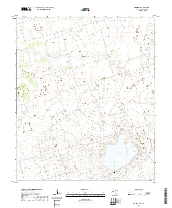
2022 Map of Shafter Lake
USGS Topo · Published 2022About this map
Shafter Lake and its surrounding alkali-flat landscape dominate this West Texas survey, illustrating a terrain defined by internal drainage and intermittent watercourses. In the southern portion of the quadrangle, the Shafter Lake Cem remains as a focal point for genealogical research, situated near the shores of the large, seasonally dry lakebed. This area of Andrews County is crisscrossed by a network of county roads and local routes, including Shrauner Rd and Fisher Rd, which serve the expansive ranching and oil-producing lands of the Llano Estacado.
Find a feature on this map
20 named features on this map. Tap any name to fly to it.
Don’t see what you’re looking for? This feature index may not catch every label — zoom into the map to look around manually.
Map Details
Editions of this 2022 Shafter Lake Map
This is the sole edition of this map. No revisions or reprints were ever made.
Other maps of this area

1954 · Hobbs
USGS Topo · 1:250,000

1958 · Hobbs
USGS Topo · 1:250,000

1963 · Andrews
USGS Topo · 1:24,000

1969 · Seminole SW
USGS Topo · 1:24,000

1970 · Seminole SE
USGS Topo · 1:24,000

1971 · Paynes Corner SE
USGS Topo · 1:24,000

1971 · Florey
USGS Topo · 1:24,000

1971 · Frankel City
USGS Topo · 1:24,000

1971 · Whalen Lake
USGS Topo · 1:24,000

1971 · Shafter Lake
USGS Topo · 1:24,000