
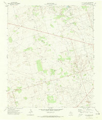
1971 Map of Whalen Lake
USGS Topo · Published 1974About this map
Whalen Lake sits at the center of this 1970s landscape, illustrating the intense intersection of West Texas hydrography and the petroleum industry. The area is dominated by large-scale energy infrastructure, with the Fullerton Oil Field and Block Thirteen Oil Field blanketing the terrain. The presence of a Gasoline Plant, a Pumping Sta, and various Oil Wells shows a territory deeply committed to extraction and processing. The topography is defined by the Fullerton Depression, a low-lying basin where industrial facilities like a Radio Facility and Water Tank are scattered among the dunes and oil pads. Aside from the small settlement at Cotten, the map reveals a landscape primarily dedicated to resource management, connected by a network of pipelines and state roads such as 176 and 181.
Find a feature on this map
19 named features on this map. Tap any name to fly to it.
Don’t see what you’re looking for? This feature index may not catch every label — zoom into the map to look around manually.
Map Details
Editions of this 1971 Whalen Lake Map
This is the sole edition of this map. No revisions or reprints were ever made.
Other maps of this area

1954 · Hobbs
USGS Topo · 1:250,000

1958 · Hobbs
USGS Topo · 1:250,000

1968 · North Cowden NW
USGS Topo · 1:24,000

1971 · Frankel City
USGS Topo · 1:24,000

1971 · Jumbo Hill
USGS Topo · 1:24,000

1971 · Figure Seven Ranch
USGS Topo · 1:24,000

1971 · Frankel City SW
USGS Topo · 1:24,000

1971 · Sand Ranch
USGS Topo · 1:24,000

1971 · Shafter Lake
USGS Topo · 1:24,000
1971 · Lazy X Ranch
USGS Topo · 1:24,000