
1971 Map of Shafter Lake
USGS Topo · Published 1974About this map
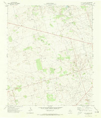
Shafter Lake dominates this West Texas landscape, surrounded by the intensive infrastructure of a widespread Oil Field as it appeared in the early 1970s. The presence of the Shafter Lake Cem on the southern shore and the small settlement of Underwood to the north suggests the historical footprint of a community centered around the playa lake and the ranching industry. Evidence of local ranching operations is visible at the Bar F Ranch, while the natural topography is defined by the winding course of Monument Draw, which cuts across the terrain north of the lake. This survey documents a specific transition in Andrews County history, where traditional land use like the ranch and cemetery coexist with the expanding energy sector, marked by numerous well sites and utility pipelines crossing the basin.
Find a feature on this map
8 named features on this map. Tap any name to fly to it.
Don’t see what you’re looking for? This feature index may not catch every label — zoom into the map to look around manually.
Map Details
Editions of this 1971 Shafter Lake Map
This is the sole edition of this map. No revisions or reprints were ever made.
Other maps of this area

1954 · Hobbs
USGS Topo · 1:250,000

1958 · Hobbs
USGS Topo · 1:250,000

1963 · Andrews
USGS Topo · 1:24,000

1969 · Seminole SW
USGS Topo · 1:24,000

1970 · Seminole SE
USGS Topo · 1:24,000

1971 · Paynes Corner SE
USGS Topo · 1:24,000

1971 · Florey
USGS Topo · 1:24,000

1971 · Frankel City
USGS Topo · 1:24,000

1971 · Whalen Lake
USGS Topo · 1:24,000
1971 · Lazy X Ranch
USGS Topo · 1:24,000