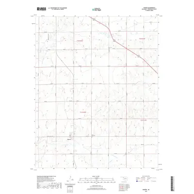
2018 Map of Sharon
USGS Topo · Published 2018About this map
Sharon serves as the primary hub for this Woodward County landscape, situated where Sharon Shattuck Rd meets the local street grid near a central Po. The surrounding terrain is defined by a dendritic network of drainages, including the various forks of Persimmon Creek, Indian Cr, and Sand Cr. This 2018 survey reveals a rural Oklahoma landscape largely shaped by the Public Land Survey System, with a regular grid of roads like N2070 Rd and E0480 Rd sectioning the land. Notable for local historians and genealogists are the North Persimmon Cem and Vonton Cem, which anchor the map's eastern and southern reaches. The presence of Creekwood Springs in the northwest corner highlights a specific named water source amidst the expansive ranching or agricultural tracts of Townships 21 and 22 North.
Find a feature on this map
76 named features on this map. Tap any name to fly to it.
Don’t see what you’re looking for? This feature index may not catch every label — zoom into the map to look around manually.
Map Details
Editions of this 2018 Sharon Map
This is the sole edition of this map. No revisions or reprints were ever made.
Other maps of this area

1955 · Woodward
USGS Topo · 1:250,000

1958 · Woodward
USGS Topo · 1:250,000

1969 · Vici NW
USGS Topo · 1:24,000

1969 · Woodward SW
USGS Topo · 1:24,000

1969 · Woodward
USGS Topo · 1:24,000

1969 · Mooreland
USGS Topo · 1:24,000

1969 · Sharon
USGS Topo · 1:24,000

1969 · Woodward NE
USGS Topo · 1:24,000

1969 · Mooreland SW
USGS Topo · 1:24,000

1969 · Mutual
USGS Topo · 1:24,000