2021 Map of Shaver Lake
USGS Topo · Published 2021About this map
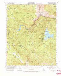
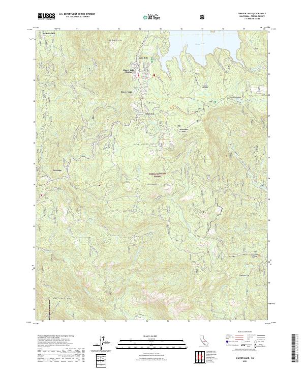
Shaver Lake serves as the central hub of this High Sierra landscape, surrounded by the dense timberlands of the Sierra National Forest. The map documents a transition from industrial activity to seasonal residency and recreation, visible in the presence of Mathews Mill and Old Bretz Mill alongside newer lakeside enclaves like Shaver Lake Heights and Dora Belle. To the west, the community of Pineridge and the Sierra Nevada settlement sit near the historic Tollhouse Rd, a primary artery through the elevation changes of the western slope. South of the lake, the terrain descends toward Soaproot Flat and Soaproot Saddle, where the rugged canyon geography is carved by Musick Cr, Taylor Cr, and the deep drainage of Blue Canyon. Local history researchers can trace the reach of the old timber industry through landmarks like Old RR Grade Bed Rd, which hints at the former rail infrastructure used to move lumber before the area became a major reservoir and recreational destination.
Find a feature on this map
96 named features on this map. Tap any name to fly to it.
Don’t see what you’re looking for? This feature index may not catch every label — zoom into the map to look around manually.
Map Details
Editions of this 2021 Shaver Lake Map
This is the sole edition of this map. No revisions or reprints were ever made.
Historical Maps of Old Bretz Mill Through Time
5 maps found