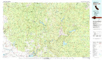
1980 Map of Shaver Lake
USGS Topo · Published 1991About this map
The San Joaquin River carves a deep path through the heart of this Sierra Nevada landscape, feeding a massive network of reservoirs and hydroelectric infrastructure. By 1980, the transition from the foothills into the high peaks was defined by major water bodies like Huntington Lake, Shaver Lake, and Bass Lake, which serve as focal points for both recreation and utility. The western edge of the map shows the legacy of the Gold Rush and early industry with sites like the Streeter Mine near Mariposa and the Daulton Mine in the lower grasslands.
Find a feature on this map
107 named features on this map. Tap any name to fly to it.
Don’t see what you’re looking for? This feature index may not catch every label — zoom into the map to look around manually.
Map Details
Editions of this 1980 Shaver Lake Map
3 editions found

Other maps of this area

1893 · Sonora
USGS Topo · 1:125,000

1896 · Sonora
USGS Topo · 1:125,000

1897 · Sonora
USGS Topo · 1:125,000

1897 · Yosemite
USGS Topo · 1:125,000

1898 · Sonora
USGS Topo · 1:125,000

1900 · Yosemite
USGS Topo · 1:125,000

1901 · Mt. Lyell
USGS Topo · 1:125,000

1903 · Yosemite
USGS Topo · 1:125,000

1903 · Tehipite
USGS Topo · 1:125,000

1904 · Kaiser
USGS Topo · 1:125,000