Loading...
Loading map...2022 Map of Shawano
USGS Topo · Published 2022About this map
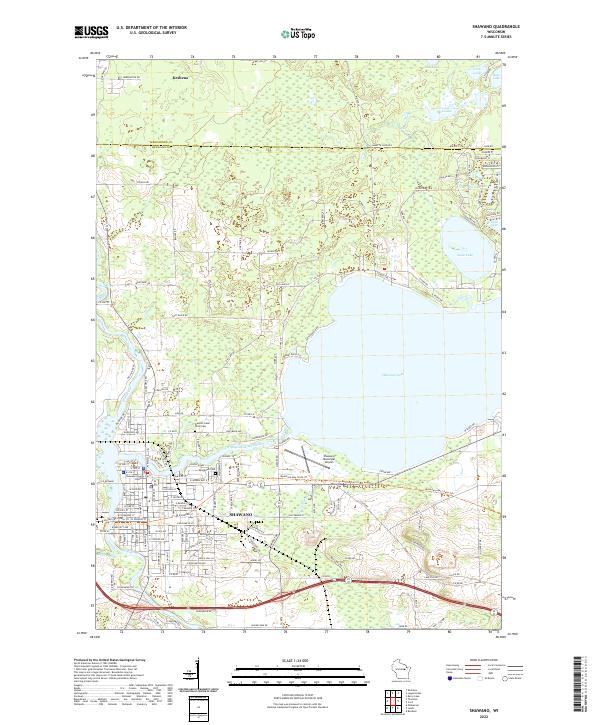
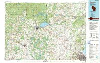
The boundary between Menominee and Shawano counties divides this landscape of glacial lakes and river bends. The city of Shawano dominates the southern portion of the map, anchored by the Shawano County Court House and extending toward the western shores of Shawano Lake. To the north, the settlement of Keshena sits near the upper margin, while the Wolf River winds south through the western sections.
Find a feature on this map
120 named features on this map. Tap any name to fly to it.
Don’t see what you’re looking for? This feature index may not catch every label — zoom into the map to look around manually.
Map Details
Date Portrayed2022
Date Published2022
PublisherU.S. Geological Survey
Map TypeTopographic
Scale1:24000
Physical Dimensions24 x 29 inches
Editions of this 2022 Shawano Map
This is the sole edition of this map. No revisions or reprints were ever made.
Historical Maps of Washington Through Time
5 maps found
Featured Locations
Source Details
SourceU.S. Geological Survey
CopyrightPublic Domain