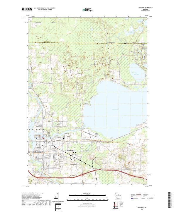
2022 Map of Shawano
USGS Topo · Published 2022About this map
The boundary between Menominee and Shawano counties divides this landscape of glacial lakes and river bends. The city of Shawano dominates the southern portion of the map, anchored by the Shawano County Court House and extending toward the western shores of Shawano Lake. To the north, the settlement of Keshena sits near the upper margin, while the Wolf River winds south through the western sections.
Find a feature on this map
120 named features on this map. Tap any name to fly to it.
Don’t see what you’re looking for? This feature index may not catch every label — zoom into the map to look around manually.
Map Details
Editions of this 2022 Shawano Map
This is the sole edition of this map. No revisions or reprints were ever made.
Other maps of this area

1954 · Shawano
USGS Topo · 1:48,000

1955 · Embarrass
USGS Topo · 1:48,000

1955 · Seymour
USGS Topo · 1:62,500

1955 · Green Bay
USGS Topo · 1:250,000

1956 · Gillett
USGS Topo · 1:62,500

1964 · Shawano
USGS Topo · 1:62,500

1969 · Embarrass
USGS Topo · 1:24,000

1969 · Lunds
USGS Topo · 1:24,000

1974 · Cecil
USGS Topo · 1:24,000
1974 · Berry Lake
USGS Topo · 1:24,000