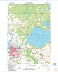
1982 Map of Shawano
USGS Topo · Published 1982About this map
The Menominee Indian Reservation occupies the northern half of this landscape, its heavily forested interior contrasting with the developed recreational and industrial zones to the south. Central to the area's geography is the massive expanse of Shawano Lake, which supports a variety of shoreline amenities including the Shalagoco Country Club and the Shawano Seaplane Base. The city of Shawano itself is a hub of civic and religious life, anchored by the Courthouse and several parochial institutions like Sacred Heart Ch and St James Sch.
Find a feature on this map
73 named features on this map. Tap any name to fly to it.
Don’t see what you’re looking for? This feature index may not catch every label — zoom into the map to look around manually.
Map Details
Editions of this 1982 Shawano Map
This is the sole edition of this map. No revisions or reprints were ever made.
Other maps of this area

1954 · Shawano
USGS Topo · 1:48,000

1955 · Embarrass
USGS Topo · 1:48,000

1955 · Seymour
USGS Topo · 1:62,500

1955 · Green Bay
USGS Topo · 1:250,000

1956 · Gillett
USGS Topo · 1:62,500

1964 · Shawano
USGS Topo · 1:62,500

1969 · Embarrass
USGS Topo · 1:24,000

1969 · Lunds
USGS Topo · 1:24,000

1974 · Cecil
USGS Topo · 1:24,000
1974 · Berry Lake
USGS Topo · 1:24,000