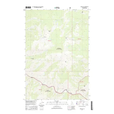
2017 Map of Sheep Hill
USGS Topo · Published 2017About this map
Salmon River flows through the southern reaches of this central Idaho landscape, carving deep through the mountains and creating a series of river bars including Deer Park Bar, Bear Bar, Nixon Bar, and Sunny Bar. These narrow alluvial terraces along the water have historically served as critical landing points and campsites for travelers navigating the river corridor. Nearby, Hancock Rapids and the steep walls of Black Canyon highlight the powerful hydrology that defines this wilderness area.
Find a feature on this map
48 named features on this map. Tap any name to fly to it.
Don’t see what you’re looking for? This feature index may not catch every label — zoom into the map to look around manually.
Map Details
Editions of this 2017 Sheep Hill Map
This is the sole edition of this map. No revisions or reprints were ever made.
Other maps of this area

1956 · Elk City
USGS Topo · 1:250,000

1960 · Elk City
USGS Topo · 1:250,000

1974 · Meadow Of Doubt
USGS Topo · 1:24,000

1977 · Boston Mtn
USGS Topo · 1:24,000

1978 · Arctic Point
USGS Topo · 1:24,000

1978 · Spread Creek Point
USGS Topo · 1:24,000

1978 · Dennis Mtn
USGS Topo · 1:24,000

1978 · Hida Point
USGS Topo · 1:24,000

1978 · Sheep Hill
USGS Topo · 1:24,000

1978 · Devils Teeth Rapids
USGS Topo · 1:24,000