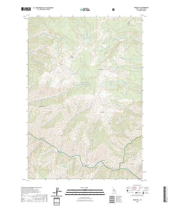
2024 Map of Sheep Hill
USGS Topo · Published 2024About this map
The Salmon Wild and Scenic River carves through the southern portion of this Idaho landscape, where the river's path is marked by isolated bars such as Nixon Bar, Sunny Bar, and Bear Bar. These river-level features contrast sharply with the high elevations of Sheep Hill and Center Mtn to the north. The area is a confluence of major protected lands, including the Frank Church-River of No Return Wilderness and portions of the Nez Perce National Forest, Payette National Forest, and Bitterroot National Forest. Topographical landmarks like Dead Man Saddle and Rattlesnake Point offer navigational anchors in a wilderness defined by water, from the geothermal waters at Hot Springs to high-altitude basins like Goat Lake and the Lake Cr Lakes.
Find a feature on this map
47 named features on this map. Tap any name to fly to it.
Don’t see what you’re looking for? This feature index may not catch every label — zoom into the map to look around manually.
Map Details
Editions of this 2024 Sheep Hill Map
This is the sole edition of this map. No revisions or reprints were ever made.
Other maps of this area

1956 · Elk City
USGS Topo · 1:250,000

1960 · Elk City
USGS Topo · 1:250,000

1974 · Meadow Of Doubt
USGS Topo · 1:24,000

1977 · Boston Mtn
USGS Topo · 1:24,000

1978 · Arctic Point
USGS Topo · 1:24,000

1978 · Spread Creek Point
USGS Topo · 1:24,000

1978 · Dennis Mtn
USGS Topo · 1:24,000

1978 · Hida Point
USGS Topo · 1:24,000

1978 · Sheep Hill
USGS Topo · 1:24,000

1978 · Devils Teeth Rapids
USGS Topo · 1:24,000