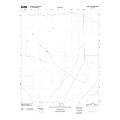
2010 Map of Sheep Mountain
USGS Topo · Published 2010About this map
Sheep Mountain dominates this arid Sierra County landscape, where the high desert is defined by its drainage patterns and isolated water sources. This 2010 U.S. Geological Survey topographic survey captures a region where survival relies on rare landmarks like Mexican Hat Spring. The terrain is marked by significant topographical shifts, most notably at Lava Gap and Sly Gap, which serve as natural breaks in the elevated ridges. To the southeast, the intermittent flow of Salt Creek winds through the basin, fed by seasonal runoffs from Sly Canyon and Lee Canyon. This map provides a technical view of the desert floor and its surrounding peaks, documenting the fundamental geography of a remote New Mexico territory.
Find a feature on this map
7 named features on this map. Tap any name to fly to it.
Don’t see what you’re looking for? This feature index may not catch every label — zoom into the map to look around manually.
Map Details
Editions of this 2010 Sheep Mountain Map
This is the sole edition of this map. No revisions or reprints were ever made.
Other maps of this area

1916 · Salinas Peak
USGS Topo · 1:125,000

1916 · Tularosa
USGS Topo · 1:125,000

1947 · Capitol Peak
USGS Topo · 1:62,500

1948 · Black Top Mountain
USGS Topo · 1:62,500

1948 · Salinas Peak
USGS Topo · 1:62,500

1948 · Lumley Lake
USGS Topo · 1:62,500

1954 · Tularosa
USGS Topo · 1:250,000

1958 · Tularosa
USGS Topo · 1:250,000

1981 · Fairview Mountain
USGS Topo · 1:24,000
1981 · Salinas Peak
USGS Topo · 1:24,000