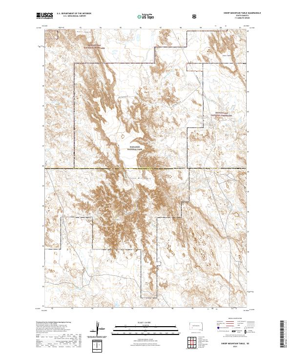
2021 Map of Sheep Mountain Table
USGS Topo · Published 2021About this map
Badlands National Park and the Buffalo Gap National Grassland dominate this section of Pennington County, showcasing a landscape defined by dramatic tablelands and creek drainages. The vast flat-topped elevations of Sheep Mtn Table, Hart Table, and Heck Table rise sharply above the surrounding prairie, illustrating the characteristic geological erosion of the region. These geographic features provided natural landmarks for travelers across the high plains, many of whom followed routes that became modern thoroughfares like BIA Hwy 27 Big Foot Trl.
Find a feature on this map
26 named features on this map. Tap any name to fly to it.
Don’t see what you’re looking for? This feature index may not catch every label — zoom into the map to look around manually.
Map Details
Editions of this 2021 Sheep Mountain Table Map
This is the sole edition of this map. No revisions or reprints were ever made.
Other maps of this area

1950 · Sheep Mountain Table
USGS Topo · 1:24,000

1950 · Stirk Table
USGS Topo · 1:24,000

1950 · Cuny Table East
USGS Topo · 1:24,000

1950 · Imlay SW
USGS Topo · 1:24,000

1950 · Imlay
USGS Topo · 1:24,000

1951 · Heutmacher Table
USGS Topo · 1:24,000

1954 · Scenic
USGS Topo · 1:24,000

1954 · Scenic SW
USGS Topo · 1:24,000

1955 · Hot Springs
USGS Topo · 1:250,000
1960 · Quinn Table SW
USGS Topo · 1:24,000