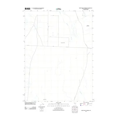
2011 Map of Sheep Ranch Springs
USGS Topo · Published 2011About this map
The Kings River meanders through the expansive King River Valley in this northern Nevada landscape. Bordered by the Montana Mountains to the northeast and the Coyote Hills to the south, the area is defined by its water sources and rural transportation network. The namesake Sheep Ranch Springs is a vital landmark in the high desert, located just off Kings River Rd. A sparse grid of roads connects the valley floor, including the long stretches of Ninemile Rd and Valley Rd. Along the eastern edge, Thacker Creek descends from the highlands, while curiosities like Old Hog John Rd point to the local history and naming conventions of Humboldt County ranching country during this early 21st-century period.
Find a feature on this map
12 named features on this map. Tap any name to fly to it.
Don’t see what you’re looking for? This feature index may not catch every label — zoom into the map to look around manually.
Map Details
Editions of this 2011 Sheep Ranch Springs Map
This is the sole edition of this map. No revisions or reprints were ever made.
Other maps of this area

1886 · Disaster
USGS Topo · 1:250,000

1893 · Disaster
USGS Topo · 1:250,000

1954 · Vya
USGS Topo · 1:250,000

1958 · Vya
USGS Topo · 1:250,000

1961 · Quinn River Crossing
USGS Topo · 1:62,500

1961 · Thacker Pass
USGS Topo · 1:62,500

1961 · Trident Peak
USGS Topo · 1:62,500

1961 · Disaster Peak
USGS Topo · 1:62,500

1962 · Vya
USGS Topo · 1:250,000

1979 · Denio
USGS Topo · 1:100,000