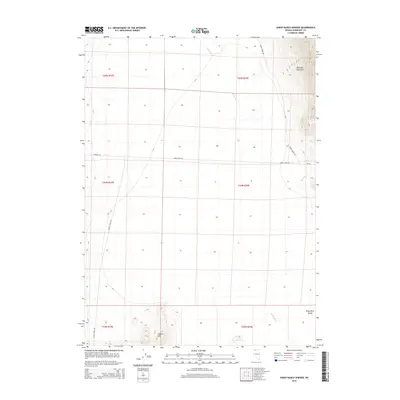
2015 Map of Sheep Ranch Springs
USGS Topo · Published 2015About this map
Kings River Valley serves as the central corridor for this arid landscape in northern Nevada, where the drainage of the Kings River flows south through the high desert. The terrain is defined by the steep elevation of the Montana Mountains in the northeast and the isolated Coyote Hills to the south. This survey illustrates the relationship between the few water sources and the sparse network of ranch roads that traverse the basin. Sheep Ranch Springs provides a critical water point near the mountain slopes, while Thacker Cr flows toward the valley floor from the east. The map details the remote transportation infrastructure of Humboldt County, documenting the routes of Kings River Rd, Coyote Point Rd, and Ninemile Rd, which follow the natural contours of the valley and its surrounding ridges.
Find a feature on this map
17 named features on this map. Tap any name to fly to it.
Don’t see what you’re looking for? This feature index may not catch every label — zoom into the map to look around manually.
Map Details
Editions of this 2015 Sheep Ranch Springs Map
This is the sole edition of this map. No revisions or reprints were ever made.
Other maps of this area

1886 · Disaster
USGS Topo · 1:250,000

1893 · Disaster
USGS Topo · 1:250,000

1954 · Vya
USGS Topo · 1:250,000

1958 · Vya
USGS Topo · 1:250,000

1961 · Quinn River Crossing
USGS Topo · 1:62,500

1961 · Thacker Pass
USGS Topo · 1:62,500

1961 · Trident Peak
USGS Topo · 1:62,500

1961 · Disaster Peak
USGS Topo · 1:62,500

1962 · Vya
USGS Topo · 1:250,000

1979 · Denio
USGS Topo · 1:100,000