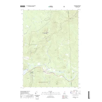
2021 Map of Shelburne
USGS Topo · Published 2021About this map
The Androscoggin River winds through the valley floor of Shelburne, New Hampshire, serving as the primary corridor for settlement and transportation between the high peaks of the White Mountain National Forest and the Mahoosuc Range. This modern survey reveals a landscape defined by its topographical extremes, where the Appalachian National Scenic Trail traverses the ridgelines near Mt Success and Mt Carlo. Along the river banks and North Rd, researchers can find established landmarks like Hazelton Cem and Lary Burbank Cem, which anchor the town's genealogy to the riverside. The map details a complex network of mountain brooks and high-elevation features, including Dryad Falls and Gentian Pond, while the border with Maine to the east is marked by the rugged heights of Hark Hill and Lary Brook.
Find a feature on this map
68 named features on this map. Tap any name to fly to it.
Don’t see what you’re looking for? This feature index may not catch every label — zoom into the map to look around manually.
Map Details
Editions of this 2021 Shelburne Map
This is the sole edition of this map. No revisions or reprints were ever made.
Other maps of this area

1893 · Gorham
USGS Topo · 1:62,500

1896 · Gorham
USGS Topo · 1:62,500

1914 · Bethel
USGS Topo · 1:62,500

1930 · Milan
USGS Topo · 1:62,500

1933 · Milan
USGS Topo · 1:62,500

1934 · Milan
USGS Topo · 1:62,500

1937 · Gorham
USGS Topo · 1:48,000

1940 · Bethel
USGS Topo · 1:62,500

1941 · Bethel
USGS Topo · 1:62,500

1942 · Gorham
USGS Topo · 1:62,500