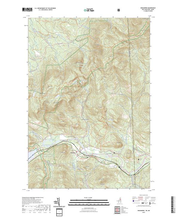
2024 Map of Shelburne
USGS Topo · Published 2024About this map
Shelburne lies at the heart of this landscape, situated along the Androscoggin River where the river valley carves through the White Mountain National Forest. The map documents a complex network of recreational and historic travel corridors, including the Appalachian National Scenic Trail as it traverses the Mahoosuc Range and passes Gentian Pond. High-elevation features like Mt Success and Bald Cap Peak dominate the northern terrain, while the river basin below contains local historical markers such as Hazelton Cem and Burbank Cem. The transition from the river bottom at Evans Island to the steep slopes of Stock Farm Mtn reflects the traditional land use patterns of Coos County, where valley settlements are hemmed in by significant mountain massifs. Modern multi-use routes like the Cross NH Adventure Trl parallel older timber and access roads like Success Pond Rd, showing the evolution of the region's mountain access.
Find a feature on this map
83 named features on this map. Tap any name to fly to it.
Don’t see what you’re looking for? This feature index may not catch every label — zoom into the map to look around manually.
Map Details
Editions of this 2024 Shelburne Map
This is the sole edition of this map. No revisions or reprints were ever made.
Other maps of this area

1893 · Gorham
USGS Topo · 1:62,500

1896 · Gorham
USGS Topo · 1:62,500

1914 · Bethel
USGS Topo · 1:62,500

1930 · Milan
USGS Topo · 1:62,500

1933 · Milan
USGS Topo · 1:62,500

1934 · Milan
USGS Topo · 1:62,500

1937 · Gorham
USGS Topo · 1:48,000

1940 · Bethel
USGS Topo · 1:62,500

1941 · Bethel
USGS Topo · 1:62,500

1942 · Gorham
USGS Topo · 1:62,500