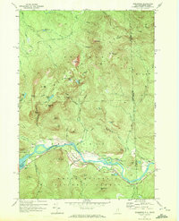
1970 Map of Shelburne
USGS Topo · Published 1972About this map
The Androscoggin River carves a deep valley through the high peaks of the Mahoosuc Range in this 1970 study of the borderlands between New Hampshire and Maine. The small settlement of Shelburne serves as the focal point for local transportation, situated where the Grand Trunk Railway and major pipelines parallel the river's winding course. This era shows a landscape managed for both timber and recreation, with the White Mountain National Forest encompassing much of the southern terrain, while the Leadmine State Forest sits to the west. Hikers and researchers can trace the historic route of the Appalachian Trail as it climbs toward Mt Success and North Bald Cap. The map records specific backcountry infrastructure such as the Gentian Shelter and Rattle River Shelter, alongside local family landmarks like the Hazelton Cem and industrial sites including several gravel pits and a sandpit along the river banks.
Find a feature on this map
81 named features on this map. Tap any name to fly to it.
Don’t see what you’re looking for? This feature index may not catch every label — zoom into the map to look around manually.
Map Details
Editions of this 1970 Shelburne Map
3 editions found
Other maps of this area

1893 · Gorham
USGS Topo · 1:62,500

1896 · Gorham
USGS Topo · 1:62,500

1914 · Bethel
USGS Topo · 1:62,500

1930 · Milan
USGS Topo · 1:62,500

1933 · Milan
USGS Topo · 1:62,500

1934 · Milan
USGS Topo · 1:62,500

1937 · Gorham
USGS Topo · 1:48,000

1940 · Bethel
USGS Topo · 1:62,500

1941 · Bethel
USGS Topo · 1:62,500

1942 · Gorham
USGS Topo · 1:62,500