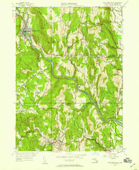
1949 Map of Shelburne Falls
USGS Topo · Published 1958About this map
Shelburne Falls sits at the northern curve of the Deerfield River, serving as a focal point for industry and transport in this 1949 topographic study. The Boston and Maine Railroad follows the river’s winding course, while the historic Mohawk Trail carves through the steep elevation of Massaemett Mountain. The landscape is characterized by narrow valleys and high ridges like Greenfield Mountain and Arthurs Seat. Local genealogy is well-represented through numerous burial sites, including Arms Cem and Skinner Cem, along with rural institutions such as the Roberts Sch. Small settlements like Conway, Bardwell, and Burkville are mapped with precision, showing the distribution of farmsteads and homes before the post-war expansion significantly altered these rural Franklin County corridors.
Find a feature on this map
66 named features on this map. Tap any name to fly to it.
Don’t see what you’re looking for? This feature index may not catch every label — zoom into the map to look around manually.
Map Details
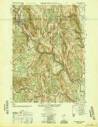
Editions of this 1949 Shelburne Falls Map
2 editions found
Other maps of this area

1885 · Northampton
USGS Topo · 1:62,500

1886 · Hawley
USGS Topo · 1:62,500

1886 · Chesterfield
USGS Topo · 1:62,500

1886 · Northampton
USGS Topo · 1:62,500

1888 · Chesterfield
USGS Topo · 1:62,500

1890 · Hawley
USGS Topo · 1:62,500

1890 · Greenfield
USGS Topo · 1:62,500

1891 · Northampton
USGS Topo · 1:62,500

1893 · Northampton
USGS Topo · 1:62,500

1893 · Chesterfield
USGS Topo · 1:62,500