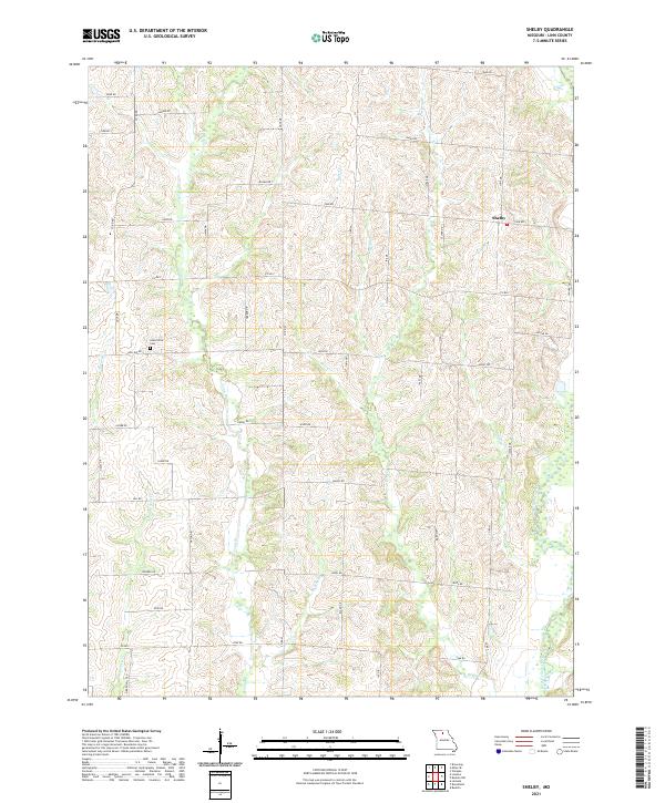
2021 Map of Shelby
USGS Topo · Published 2021About this map
Shelby sits atop the high ground of northwestern Linn County, where a network of county roads like Co RD C and Co RD V connects the surrounding agricultural landscape. This portion of Missouri is defined by a dense system of seasonal streams and creek branches that drain the rolling terrain. The West Yellow Creek corridor runs along the eastern edge, while the western side is dominated by the winding paths of Turkey Cr and Big Turkey Cr.
Find a feature on this map
54 named features on this map. Tap any name to fly to it.
Don’t see what you’re looking for? This feature index may not catch every label — zoom into the map to look around manually.
Map Details
Editions of this 2021 Shelby Map
This is the sole edition of this map. No revisions or reprints were ever made.
Other maps of this area

1946 · Brookfield
USGS Topo · 1:62,500

1948 · Brookfield
USGS Topo · 1:62,500

1949 · Bucklin
USGS Topo · 1:24,000

1949 · Bucklin NW
USGS Topo · 1:24,000

1950 · Bucklin
USGS Topo · 1:24,000

1950 · Bucklin NW
USGS Topo · 1:24,000

1953 · Moberly
USGS Topo · 1:250,000

1954 · Centerville
USGS Topo · 1:250,000

1954 · Moberly
USGS Topo · 1:250,000

1957 · Moberly
USGS Topo · 1:250,000