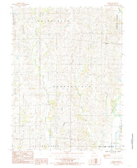
1984 Map of Shelby
USGS Topo · Published 1985About this map
The small settlement of Shelby anchors this rural landscape in northern Missouri during the early 1980s. Located within the townships of North Salem, Enterprise, and Grantsville, the area is defined by a dense network of tributaries flowing south toward the larger river basins. Notable waterways such as West Yellow Creek, Bear Creek, and Big Turkey Creek create a rolling topography of creek bottoms and wooded draws.
Find a feature on this map
16 named features on this map. Tap any name to fly to it.
Don’t see what you’re looking for? This feature index may not catch every label — zoom into the map to look around manually.
Map Details
Editions of this 1984 Shelby Map
This is the sole edition of this map. No revisions or reprints were ever made.
Other maps of this area

1946 · Brookfield
USGS Topo · 1:62,500

1948 · Brookfield
USGS Topo · 1:62,500

1949 · Bucklin
USGS Topo · 1:24,000

1949 · Bucklin NW
USGS Topo · 1:24,000

1950 · Bucklin
USGS Topo · 1:24,000

1950 · Bucklin NW
USGS Topo · 1:24,000

1953 · Moberly
USGS Topo · 1:250,000

1954 · Centerville
USGS Topo · 1:250,000

1954 · Moberly
USGS Topo · 1:250,000

1957 · Moberly
USGS Topo · 1:250,000