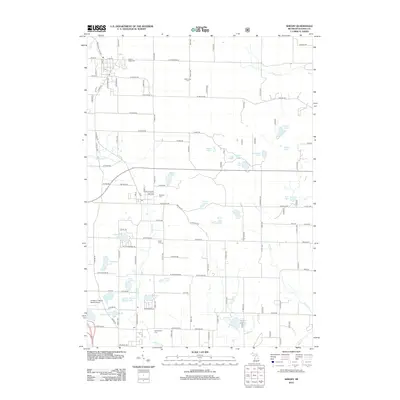
2012 Map of Shelby
USGS Topo · Published 2012About this map
Mount Hope Cem and the surrounding township of Shelby reflect a landscape defined by small-scale agriculture and established local landmarks in the early 21st century. The map reveals a high concentration of historic burial grounds, including the Mennonite Cem and New Era Cem, which serve as vital points of reference for genealogical research in this part of Michigan. The local geography is heavily influenced by glacial water bodies and wetlands, from the expansive Potters Marsh in the northeast to Bear Lake and Lake Sixteen. Transportation is anchored by S Oceana Dr and S State St, connecting the community centers to rural outposts. Further south, the Double JJ Resort Ranch Airport near Wildcat Lake represents the region's intersection of recreation and private aviation, while numerous small tributaries like Carlton Cr and Robinson Cr drain the interior toward the Great Lakes basin.
Find a feature on this map
106 named features on this map. Tap any name to fly to it.
Don’t see what you’re looking for? This feature index may not catch every label — zoom into the map to look around manually.
Map Details
Editions of this 2012 Shelby Map
This is the sole edition of this map. No revisions or reprints were ever made.
Other maps of this area

1929 · Montague
USGS Topo · 1:48,000

1931 · Hart NW
USGS Topo · 1:31,680

1931 · Hart SE
USGS Topo · 1:31,680

1931 · Hart NE
USGS Topo · 1:31,680

1931 · Walkerville SW
USGS Topo · 1:31,680

1931 · Walkerville NW
USGS Topo · 1:31,680

1954 · Milwaukee
USGS Topo · 1:250,000

1958 · Milwaukee
USGS Topo · 1:250,000

1958 · Hesperia
USGS Topo · 1:62,500

1958 · Twin Lake
USGS Topo · 1:62,500