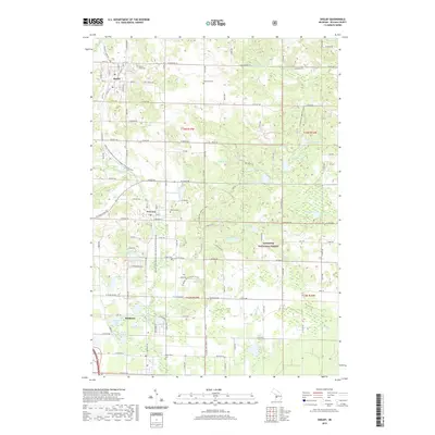
2019 Map of Shelby
USGS Topo · Published 2019About this map
Shelby anchors this coastal-adjacent landscape, situated within a patchwork of orchards and woodlands just inland from Lake Michigan. The map captures a transition from the village centers of New Era and Rothbury into the dense eastern timber of the Manistee National Forest. This 2019 survey documents a region defined by its numerous small inland waters, including Pigeon Lake, Weber Lake, and the expansive Potters Marsh to the northeast. Local history and genealogy are well represented by several established burial grounds such as Mount Hope Cem, Mennonite Cem, and Assumption Cem. The presence of the William Field Memorial Hart-Montague Trail State Park following an old rail corridor highlights the area's conversion of industrial infrastructure into recreational space. Significant wetlands and creeks like Dorrance Cr and Robinson Cr drain the glacial terrain, illustrating the intricate hydrology that supports the local agricultural economy.
Find a feature on this map
87 named features on this map. Tap any name to fly to it.
Don’t see what you’re looking for? This feature index may not catch every label — zoom into the map to look around manually.
Map Details
Editions of this 2019 Shelby Map
This is the sole edition of this map. No revisions or reprints were ever made.
Other maps of this area

1929 · Montague
USGS Topo · 1:48,000

1931 · Hart NW
USGS Topo · 1:31,680

1931 · Hart SE
USGS Topo · 1:31,680

1931 · Hart NE
USGS Topo · 1:31,680

1931 · Walkerville SW
USGS Topo · 1:31,680

1931 · Walkerville NW
USGS Topo · 1:31,680

1954 · Milwaukee
USGS Topo · 1:250,000

1958 · Milwaukee
USGS Topo · 1:250,000

1958 · Hesperia
USGS Topo · 1:62,500

1958 · Twin Lake
USGS Topo · 1:62,500