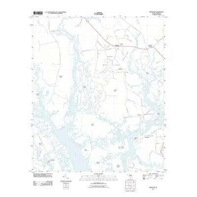
2011 Map of Sheldon
USGS Topo · Published 2011About this map
Sheldon and its surroundings in northern Beaufort County are defined by a complex network of tidal waterways and agricultural land. The inland landscape is crossed by historically significant routes like Old Sheldon Church Rd and Stoney Creek Cemetery Rd, names that hint at the colonial-era foundations of this coastal region. The Sheldon Lookout Tower stands as a prominent landmark near the settlement center. Moving south toward the coast, the terrain breaks into numerous points and islands, including Mackay Point and Brays Island, as the land gives way to the Broad River and the Whale Branch. The presence of the Seabrook Post Office and small clusters at Fairview and Gardens Corner illustrate the dispersed, rural character of the Lowcountry at the start of the 21st century.
Find a feature on this map
75 named features on this map. Tap any name to fly to it.
Don’t see what you’re looking for? This feature index may not catch every label — zoom into the map to look around manually.
Map Details
Editions of this 2011 Sheldon Map
This is the sole edition of this map. No revisions or reprints were ever made.
Other maps of this area

1918 · Green Pond
USGS Topo · 1:62,500

1918 · Yemassee
USGS Topo · 1:62,500

1920 · Okatie
USGS Topo · 1:62,500

1942 · Okatie
USGS Topo · 1:62,500

1943 · Yemassee
USGS Topo · 1:62,500

1943 · Green Pond
USGS Topo · 1:62,500

1944 · Fort Fremont
USGS Topo · 1:62,500

1947 · Savannah
USGS Topo · 1:250,000

1948 · Savannah
USGS Topo · 1:250,000

1957 · Savannah
USGS Topo · 1:250,000