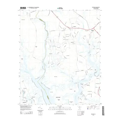
2014 Map of Sheldon
USGS Topo · Published 2014About this map
Sheldon and the surrounding Lowcountry marshlands define this coastal landscape where the Pocotaligo River meets the Broad River. The area is characterized by a complex network of islands and tidal passages, including Halls Island, Port Royal Island, and Brays Island. Local history is anchored by thoroughfares like Old Sheldon Church Rd and Stoney Creek Cemetery Rd, which hint at the region's deep colonial and ecclesiastical roots. The economy of the era is reflected in the path of CSX Transportation through the settlements of Seabrook and Coosaw. The presence of numerous named necks and points, such as Grahams Neck and Mackay Point, illustrates how the geography of the Tulifiny River and Coosawhatchie River shaped local development and transit. This survey offers a detailed view of the interaction between the land and the extensive waterways like Whale Branch and Haulover Creek.
Find a feature on this map
120 named features on this map. Tap any name to fly to it.
Don’t see what you’re looking for? This feature index may not catch every label — zoom into the map to look around manually.
Map Details
Editions of this 2014 Sheldon Map
This is the sole edition of this map. No revisions or reprints were ever made.
Other maps of this area

1918 · Green Pond
USGS Topo · 1:62,500

1918 · Yemassee
USGS Topo · 1:62,500

1920 · Okatie
USGS Topo · 1:62,500

1942 · Okatie
USGS Topo · 1:62,500

1943 · Yemassee
USGS Topo · 1:62,500

1943 · Green Pond
USGS Topo · 1:62,500

1944 · Fort Fremont
USGS Topo · 1:62,500

1947 · Savannah
USGS Topo · 1:250,000

1948 · Savannah
USGS Topo · 1:250,000

1957 · Savannah
USGS Topo · 1:250,000