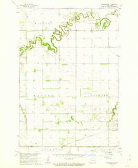
1961 Map of Sheldon NE
USGS Topo · Published 1963About this map
The Maple River carves a winding course through the prairie of southeastern North Dakota, defining the landscape of Walburg and Watson townships. This 1961 survey depicts a transition in the rural economy, where the Northern Pacific railroad cuts across the southern plains, connecting the small centers of Leonard and Coburn. Genealogists will find critical local landmarks such as Watson Cem and Leonard Cem, providing precise locations for early pioneer burials near the township lines. The topography is meticulously detailed, capturing the intricate drainage patterns leading into the river valley and the scattered farmsteads that defined the region's agricultural footprint. Multi-county boundaries are clearly marked, showing the meeting of Cass, Ransom, and Richland counties near the southern edge of the quadrangle, which includes parts of Helendale township.
Find a feature on this map
11 named features on this map. Tap any name to fly to it.
Don’t see what you’re looking for? This feature index may not catch every label — zoom into the map to look around manually.
Map Details
Editions of this 1961 Sheldon NE Map
This is the sole edition of this map. No revisions or reprints were ever made.
Other maps of this area

1895 · Casselton
USGS Topo · 1:125,000

1897 · Casselton
USGS Topo · 1:125,000

1953 · Fargo
USGS Topo · 1:250,000

1956 · Fargo
USGS Topo · 1:250,000

1959 · Leonard
USGS Topo · 1:24,000

1960 · Power
USGS Topo · 1:24,000

1960 · Coburn
USGS Topo · 1:24,000
1960 · Sheldon
USGS Topo · 1:24,000

1961 · Durbin
USGS Topo · 1:24,000

1961 · Sheldon NW
USGS Topo · 1:24,000