
1960 Map of Coburn
USGS Topo · Published 1962About this map
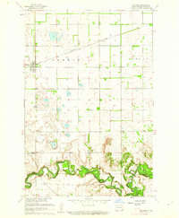
The Sheyenne River dominates this 1960 landscape, carving a deep, meandering valley through the prairie of Ransom and Richland Counties. This survey illustrates the contrast between the flat, grid-based agricultural lands of Coburn and Helendale townships and the broken terrain of the river bottoms. In the southern portion of the sheet, the river is crossed by the Vivasaker Bridge, serving as a vital link in the local road network near the Owego district. Cultural landmarks such as the Owego Ch provide fixed points for genealogical research in this rural area. To the north, the Northern Pacific railroad cuts through the settlement of Coburn, which serves as a small rail siding and shipping point amidst the expansive North Dakota wheat fields.
Find a feature on this map
10 named features on this map. Tap any name to fly to it.
Don’t see what you’re looking for? This feature index may not catch every label — zoom into the map to look around manually.
Map Details
Editions of this 1960 Coburn Map
This is the sole edition of this map. No revisions or reprints were ever made.
Other maps of this area

1895 · Casselton
USGS Topo · 1:125,000

1897 · Casselton
USGS Topo · 1:125,000

1907 · Wyndmere
USGS Topo · 1:125,000

1953 · Fargo
USGS Topo · 1:250,000

1956 · Fargo
USGS Topo · 1:250,000

1959 · Leonard
USGS Topo · 1:24,000

1960 · Power
USGS Topo · 1:24,000

1960 · Wyndmere NW
USGS Topo · 1:24,000

1960 · Venlo
USGS Topo · 1:24,000
1960 · Sheldon
USGS Topo · 1:24,000