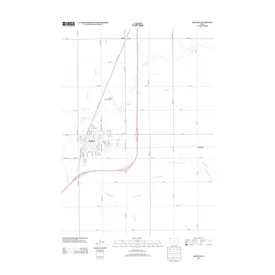
2013 Map of Sheldon
USGS Topo · Published 2013About this map
Sheldon serves as the primary hub of this O'Brien County landscape, organized by a rigid section-line grid that defines the agricultural character of northwestern Iowa. The town's layout is anchored by a historic transportation corridor including Railroad Ave and an extensive network of named streets like Iselin Ave, Wyman St, and 11th St. To the north, the Sheldon Municipal Airport occupies a significant portion of the prairie, while the outlying settlements of Ritter and Evander mark the intersections of rural life beyond the city limits.
Find a feature on this map
70 named features on this map. Tap any name to fly to it.
Don’t see what you’re looking for? This feature index may not catch every label — zoom into the map to look around manually.
Map Details
Editions of this 2013 Sheldon Map
This is the sole edition of this map. No revisions or reprints were ever made.
Other maps of this area

1954 · Fairmont
USGS Topo · 1:250,000

1958 · Fairmont
USGS Topo · 1:250,000

1964 · Hospers
USGS Topo · 1:24,000

1964 · Matlock
USGS Topo · 1:24,000

1964 · Sheldon SE
USGS Topo · 1:24,000

1964 · Sheldon
USGS Topo · 1:24,000

1964 · Primghar
USGS Topo · 1:24,000

1964 · Sanborn
USGS Topo · 1:24,000

1972 · Ashton
USGS Topo · 1:24,000
1972 · George East
USGS Topo · 1:24,000