
1964 Map of Sheldon
USGS Topo · Published 1965About this map
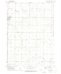
The Floyd River and its various tributaries, including Little Floyd River and Wolf Creek, define the landscape of northwest Iowa where Sioux and O'Brien Counties meet. This mid-1960s survey documents Sheldon as a thriving regional hub, marked by a dense grid of city streets and several key community institutions such as City Hall, the Community Hospital, and East School. The town's significance as a transportation and industrial center is evidenced by the intersection of three major railroads: the Chicago and North Western, the Chicago Milwaukee St Paul and Pacific, and the Illinois Central. Beyond the city limits, the landscape transitions into a systematic pattern of agricultural sections, dotted with numerous Gravel Pits and local landmarks like the Sheldon Country Club and the small settlement of Ritter near the northern boundary. Genealogists will find the three local cemeteries—St Patricks, East Lawn, and St Paul—useful for locating historic family plots in the area.
Find a feature on this map
27 named features on this map. Tap any name to fly to it.
Don’t see what you’re looking for? This feature index may not catch every label — zoom into the map to look around manually.
Map Details
Editions of this 1964 Sheldon Map
This is the sole edition of this map. No revisions or reprints were ever made.
Other maps of this area

1954 · Fairmont
USGS Topo · 1:250,000

1958 · Fairmont
USGS Topo · 1:250,000

1964 · Hospers
USGS Topo · 1:24,000

1964 · Matlock
USGS Topo · 1:24,000

1964 · Sheldon SE
USGS Topo · 1:24,000

1964 · Primghar
USGS Topo · 1:24,000

1964 · Sanborn
USGS Topo · 1:24,000

1972 · Ashton
USGS Topo · 1:24,000
1972 · George East
USGS Topo · 1:24,000

1972 · Cloverdale
USGS Topo · 1:24,000